
Drone protection for critical infrastructure
Detect and track drones.
Radar, microphones and special cameras detect and track drones at substations, power plants and waterworks. Also without a radio link to the drone.
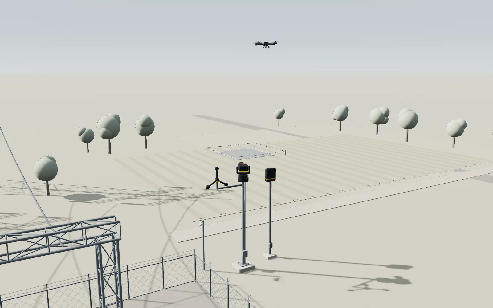
How it works


Daylight model of a substation. The drone stays outside the fence, away from the infrastructure. A compact radar node and microphones detect it together. Subtle pulses show both passing direction and position to the special camera. It turns to the cue and tracks the drone. The supplied sensor image appears in the Track step. The team and authorised body receive an alert with the time and flight path. The partner system catches the drone over distant open ground and sets it down there.
Detect
A low-emission, low-cost radar node and microphones detect drones early at 1 to 2 km. Together they give the special cameras a cue with direction and position. This works without a radio link to the drone.
≈1.5 km Illustrative distance from the sensor.
Track
The special cameras turn towards the reported position and track the drone precisely, even against the sun.
≈1.5 km Illustrative distance from the sensor.
Special camera view 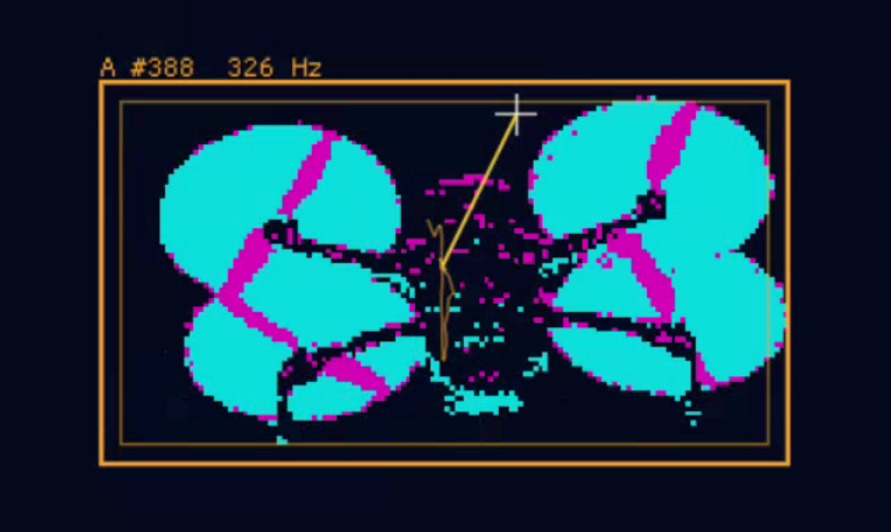
Supplied sensor image. Its recording distance is not specified.
Report
Your team and the authorised body receive an alert with the time and flight path. Both are logged.
Capture
An authorised body uses a partner's capture drone. It catches the drone with a net over distant open ground and sets it down there. Both stay away from the site.
Illustrative scenario. Radar and interceptor drone: partner systems. Intervention only by authorised bodies.
Why now
Since then the RKEG has applied in Austria
1 March 2026
sourcedSource: Resilienz kritischer Einrichtungen-Gesetz (RKEG)
Since 1 March 2026, the RKEG has applied in Austria. Operators of critical entities need a resilience plan, including for physical protection. For many, the risk analysis and resilience plan are due in 2027.
Depending on the threat, this can also include systems for drone detection.
Many systems detect drones by their radio signal. Drones with a fibre optic link or an autopilot do not need radio.
Benefits for your site
- Early warning, even for drones without a radio signal.
- A low-emission, low-cost radar node for early detection.
- Analysis happens on site. Your data stays with you.
- Logged times and tracks for incident reporting.
- Complements existing systems such as radar or radio detectors.
- Developed in Innsbruck.
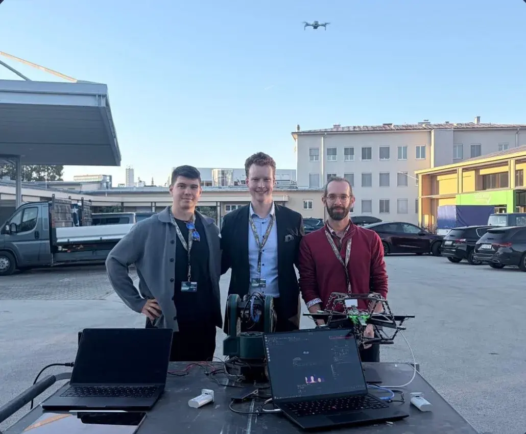
Field test: hearing and tracking
October 2026
The first step: your Drone Check
Measurement data on drone activity at your site.
The RKEG has been in force since March 2026. Your risk analysis must cover the hazards to your site. The Ministry of the Interior names drones explicitly. The Drone Check delivers this chapter for you, with real measurement data instead of estimates.
Request a Drone CheckAssess the site
We assess potential approach routes, visibility from outside, existing protection and reporting procedures against the EU guidelines for critical entities.
We measure
Our sensor rack stays with you for two to four weeks. It records every alert and shows how loud your site is, and when. With registered test flights, we show what it detects. Analysis happens on site; your data stays with you.
Document the risk assessment
You receive a chapter for your risk analysis and resilience plan covering hazards, gaps in protection and recommended measures. It includes the procedure for reporting an incident within 24 hours.
You decide
Use the results to decide on a site plan, a pilot project or protection in continuous operation.
Our recommendation: We recommend measures suited to your site, including products from other providers.
Frequently asked questions
Who intervenes?
In Austria, only authorised bodies may intervene at present, for example the police. We provide the precise track so they can act quickly. The capture drone comes from a partner.
Do we need a radar?
The radar node and microphones together give the special cameras a cue with direction and position. The Drone Check establishes how to integrate them at your site.
What happens to data and images?
Analysis happens on site. What is stored, we decide together with you in the pilot.
Contact
We will get back to you.